Water Quality and Weather Monitoring Data Dashboard for Downstream Users

Water Quality Display from the Data Dashboard
In 2021, MCWC worked with partners to set up a water quality and precipitation information network to address immediate needs in the year following the Grizzly Creek Fire. Equipment purchased in 2021 included placing rain gauges in seven locations in Glenwood Canyon to monitor weather, placing a 6-parameter data sonde at No Name for water quality monitoring and purchasing a refrigerated ISCO sampler. The sonde at No Name was later moved to the Glenwood Springs pedestrian bridge that crosses to Two Rivers Park above the Roaring Fork confluence.
Project work in 2022 continued to address water quality issues created from debris flows, runoff, ash flows, sedimentation and nutrient loading. Soil moisture sensors and additional in-channel water quality monitoring at downstream locations were added to the information network tracking changes to water quality and quantity.
An integrated, customizable Data Dashboard was created to display real-time information on water quality, precipitation and soil moisture conditions providing valuable and timely data to help downstream users in their decision-making process. MCWC contracted with Justin Trimble with JT Knows to build the customizable dashboard.
The Data Dashboard allows for quick analysis of activity at multiple USGS water quality monitoring sites on the Middle Colorado River and its tributaries and rain gauge/soil moisture monitoring sites in Glenwood Canyon. Water treatment plants each have a customizable dashboard to track information important to them to make decisions based on changes in water quality that can negatively impact their treatment plants. A two-tiered alert system sends notifications anytime parameters for tracking USGS information exceeds quantities that could be detrimental to the plant’s operations.
Seven towns were given access to their own dashboard: Glenwood Springs, New Castle, Silt, Rifle, Parachute, De Beque and the Battlement Mesa Metro District. Training sessions were set up with each town to share information on how to customize the dashboard to each municipality's needs and to add tracking features that would better inform each town individually. Each town also has individual access to the developer to handle troubleshooting and client queries.

Turbidity Graph for a Selected Location within the Data Dashboard
The MCWC shares their dashboard information with the public on their website for general information about water quality and water quantity. Each station also has flood watch information embedded into their dashboard. The water treatment plants can generate reports to share with other government staff on water quality changes.
The information has been instrumental this past summer in protecting water plants as the area continues to see impacts from the 2020 Grizzly Creek Fire. Towns have also been able to track stream gauge flows and see information regarding precipitation events in Glenwood Canyon.
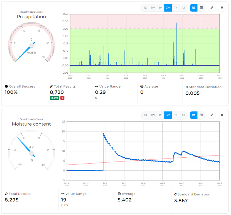
Precipitation Graph for a Selected Location within the Data Dashboard