History of Glenwood Canyon
Watershed Videos From GarPit Conservation District
—————————————————————————————————————————————————————
Wildfire Resource Directory:
Grizzly Creek Fire (2020) and Pine Gulch Fire (2020)
Drone captures debris flow off Pine Gulch Fire burn scar, Colorado
—————————————————————————————————————————————————————
landslides.usgs.gov/storymap/grizzlycreek
—————————————————————————————————————————————————————
MCWC is a partner in the Glenwood Canyon Restoration Alliance
—————————————————————————————————————————————————————
Drone footage of I-70 Glenwood Canyon damage from mudslides
—————————————————————————————————————————————————————
MCWC: Glenwood Canyon debris flow

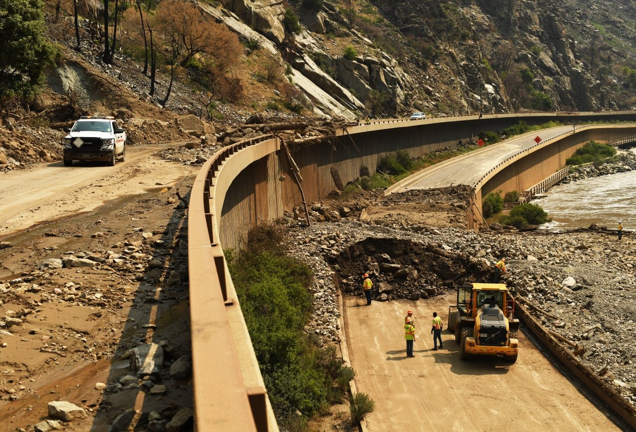
Debris Overflow in Glenwood Canyon
Rifle, CO, June 28, 2021 – This weekend’s debris flood in Glenwood Canyon was a result of the multiple days of rain on the Grizzly Creek burn scar. Flash flooding and debris flows are more likely to occur when spring, summer and fall rains run over fire damaged soil where vegetation has been burned away. To protect people and infrastructure who are in the vicinity of a burn scar in the first years after a fire, a heightened awareness of changes in weather and a warning system needs to be in place to get information out to the public as quickly as possible.
The Middle Colorado Watershed Council was awarded funding in May from the Colorado Water Conservation Board to place rain gauges in Glenwood Canyon to enhance the local weather communication network. MCWC worked in coordination with CDOT, USGS and the National Weather Service to determine the best placement for the additional gauges in the canyon.
Working with USGS, the gauges will be placed on perimeter points on the canyon to heighten awareness of incoming storms from the northwest, southwest and east (see map). CDOT also has placed two gauges at other perimeter points in the canyon. Additional tracking will be done in certain drainages to monitor unstable air parcels that could produce extreme precipitation events in areas of higher concern: CDOT’s operation center in the middle of the canyon; recreation activity at Hanging Lake; and Glenwood’s public water intake and the No Name community.
Once the final sites were confirmed by the USGS and CDOT, access agreements needed to be obtained from private landowners and the U.S. Forest Service to get the gauges in place before the summer monsoons which typically start in the beginning of July.
When the gauges are in place, the National Weather Service in Grand Junction will receive more timely weather information, who in turn, will communicate with CDOT. The additional information will provide more accuracy in determining whether a Glenwood Canyon closure is necessary and how quickly it must be done.
With additional future funding, these gauges will remain in place to monitor weather for the next three to five years.