Grizzly Creek Fire: Post Monitoring Water Quality, Runoff, and Soil
Grizzly Creek fire and post fire photos courtesy CDOT, Mike Sawyer, Frank Martin and MCWC.
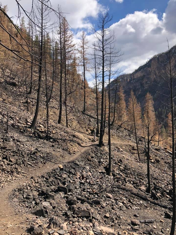
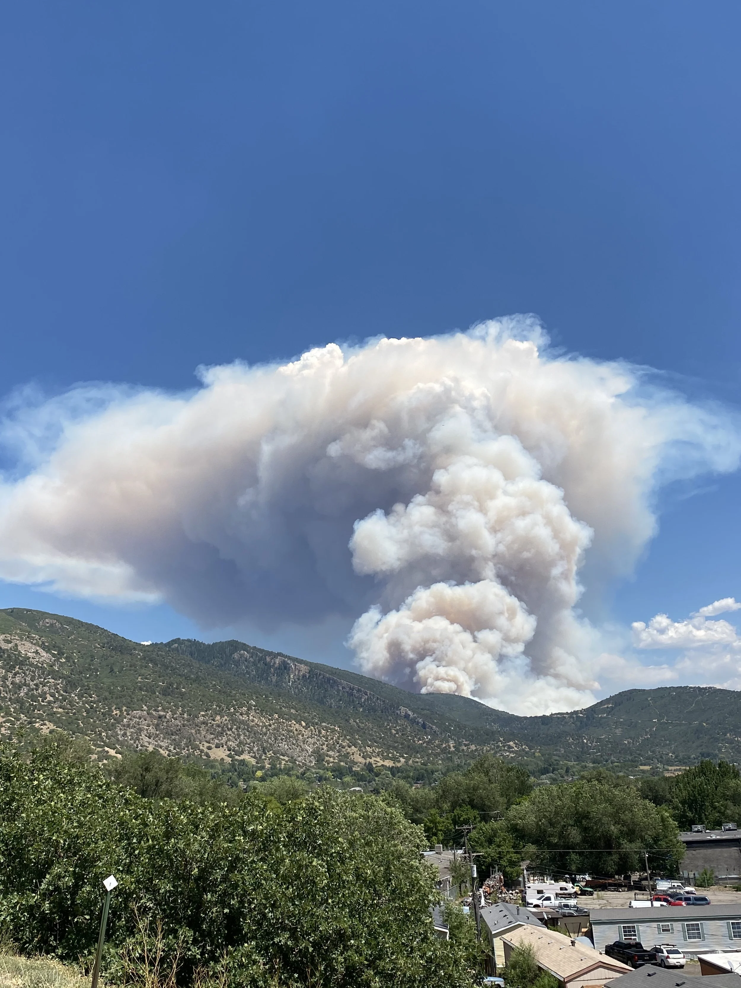
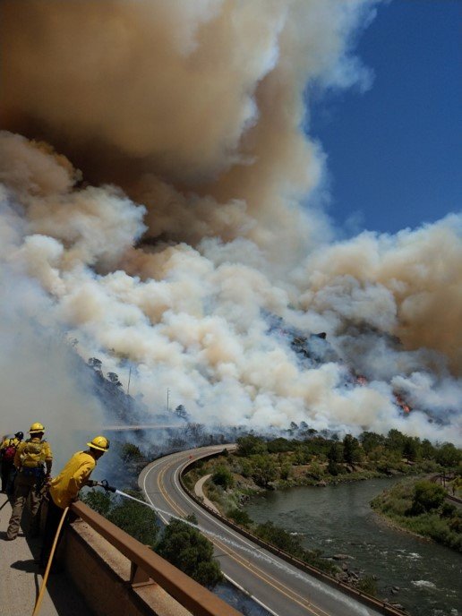
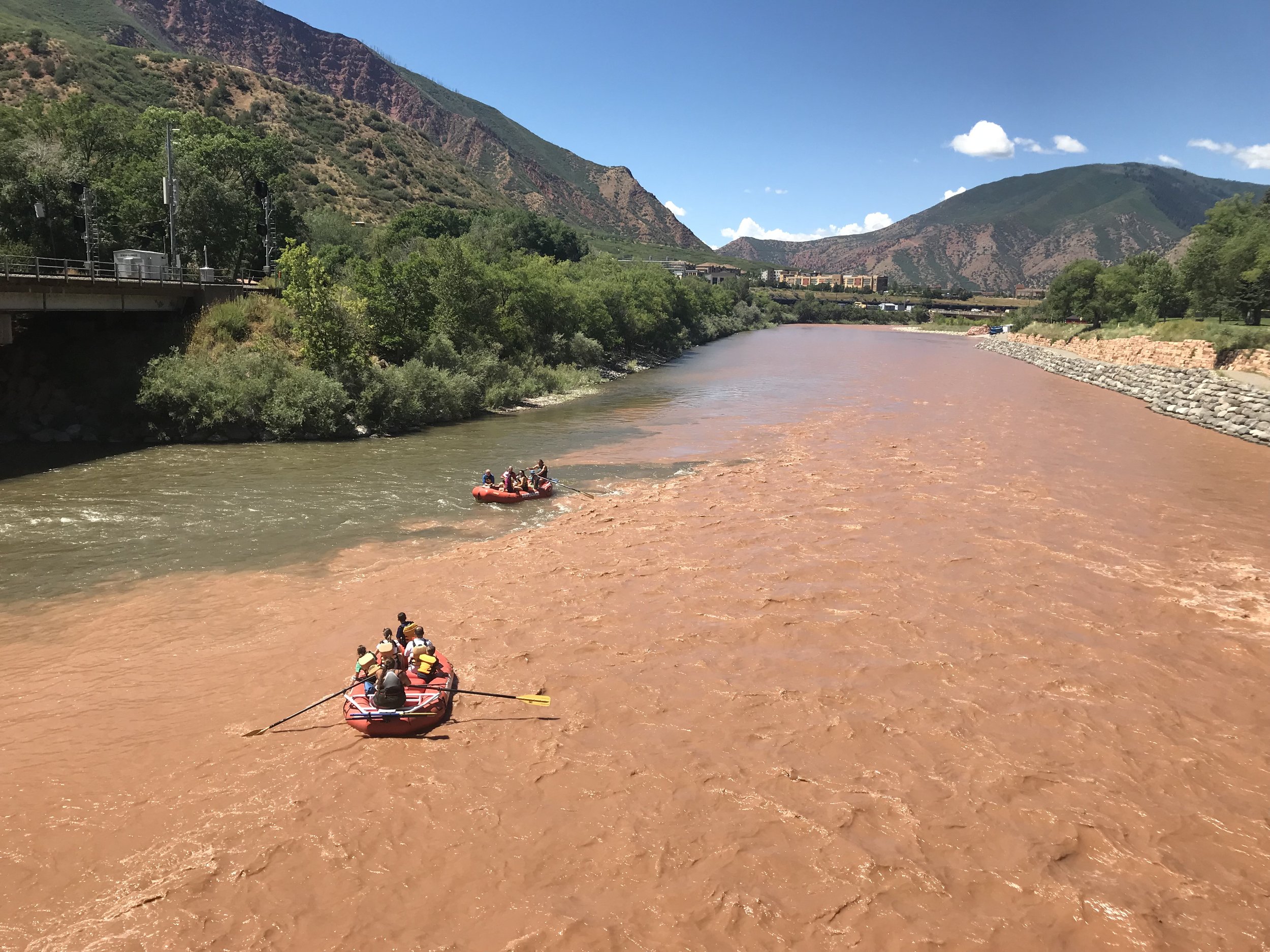
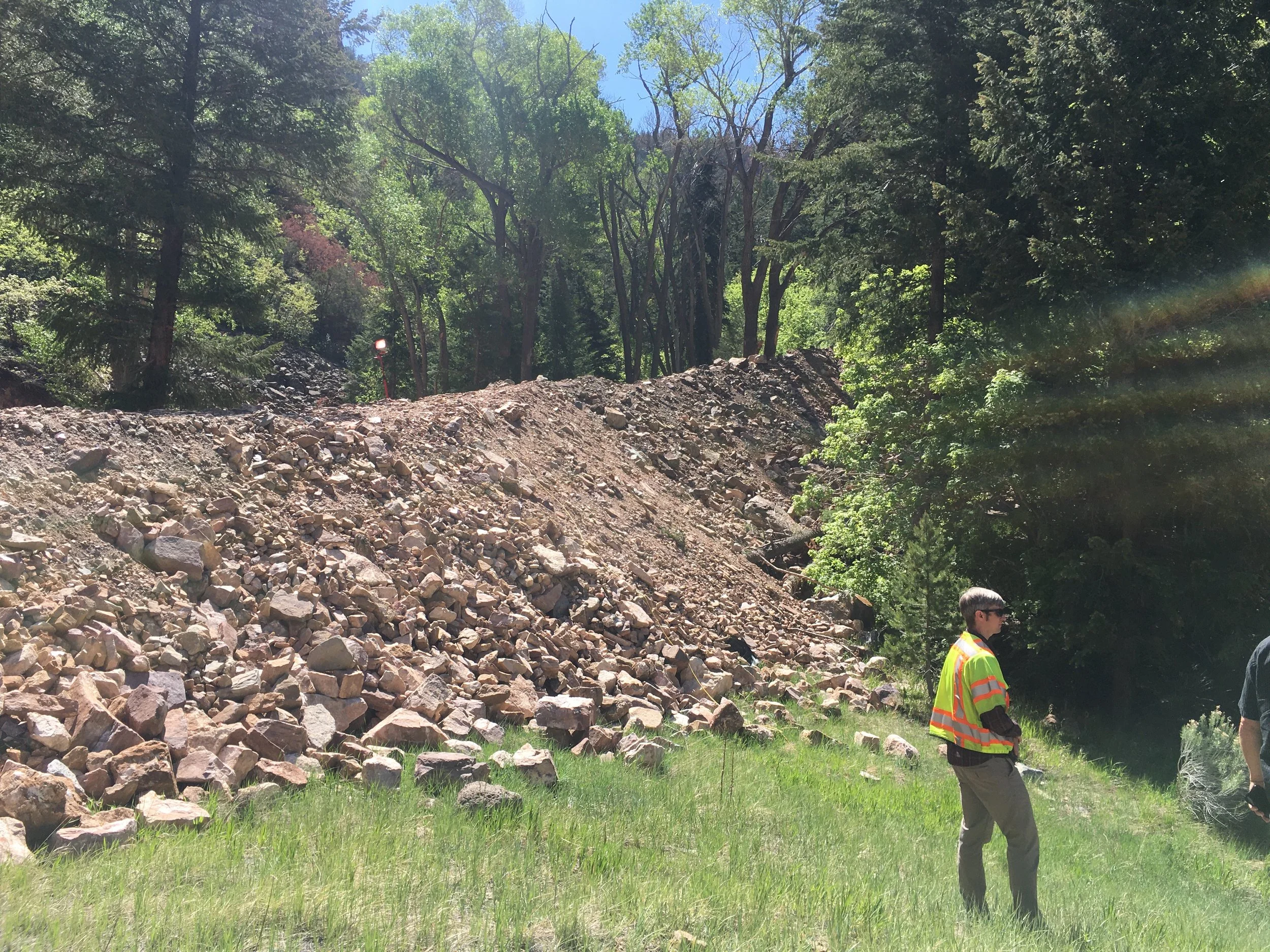
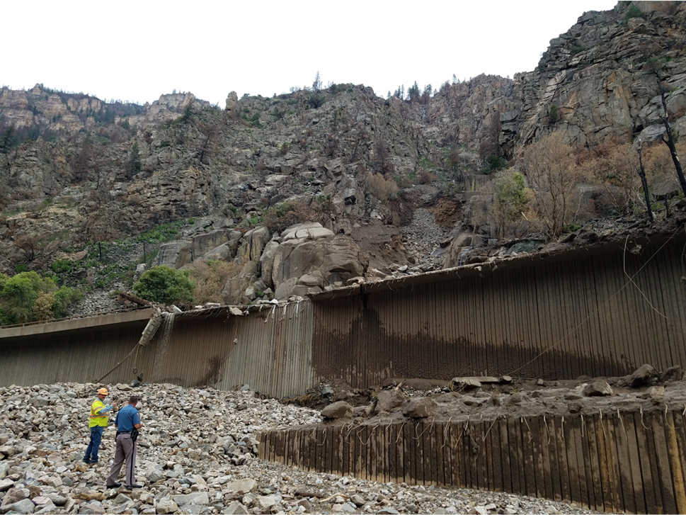
The Grizzly Creek Fire burned 32,631 acres over 131 days, beginning on August 10, 2020, and left local communities vulnerable to lasting wildfire impacts. The fire affected water quality, ecosystems, and caused increased erosion and flooding. In response, the Middle Colorado Watershed Council (MCWC) has actively worked to monitor these effects and support mitigation efforts for the future.
In 2021, MCWC partnered with others to establish a water quality and precipitation monitoring network to address immediate post fire needs. This included installing rain gauges at seven locations in Glenwood Canyon to track storm events, deploying a 6-parameter data sonde at No Name Creek for water quality monitoring, and purchasing refrigerated ISCO and isokinetic samplers with associated equipment for automatic sampling of the Colorado River. Water quality sampling included baseline measurements before the first runoff post fire, as well as during and after runoff and debris flows.
Efforts expanded in 2022 to address water quality issues from debris flows, sedimentation, ash, and nutrient loading. New soil moisture sensors and additional water quality monitors were installed downstream to better track changes in water quality and quantity.
Data from the rain gauge network supported the National Oceanic and Atmospheric Administration (NOAA), National Weather Service (NWS), and Colorado Department of Transportation (CDOT) in issuing timely flash flood warnings in Glenwood Canyon. Additionally, an integrated, customizable Data Dashboard was created to display real-time information on water quality, precipitation, and soil moisture.

Courtesy CDOT, Mike Sawyer
USGS Sampling and Equipment Deployment
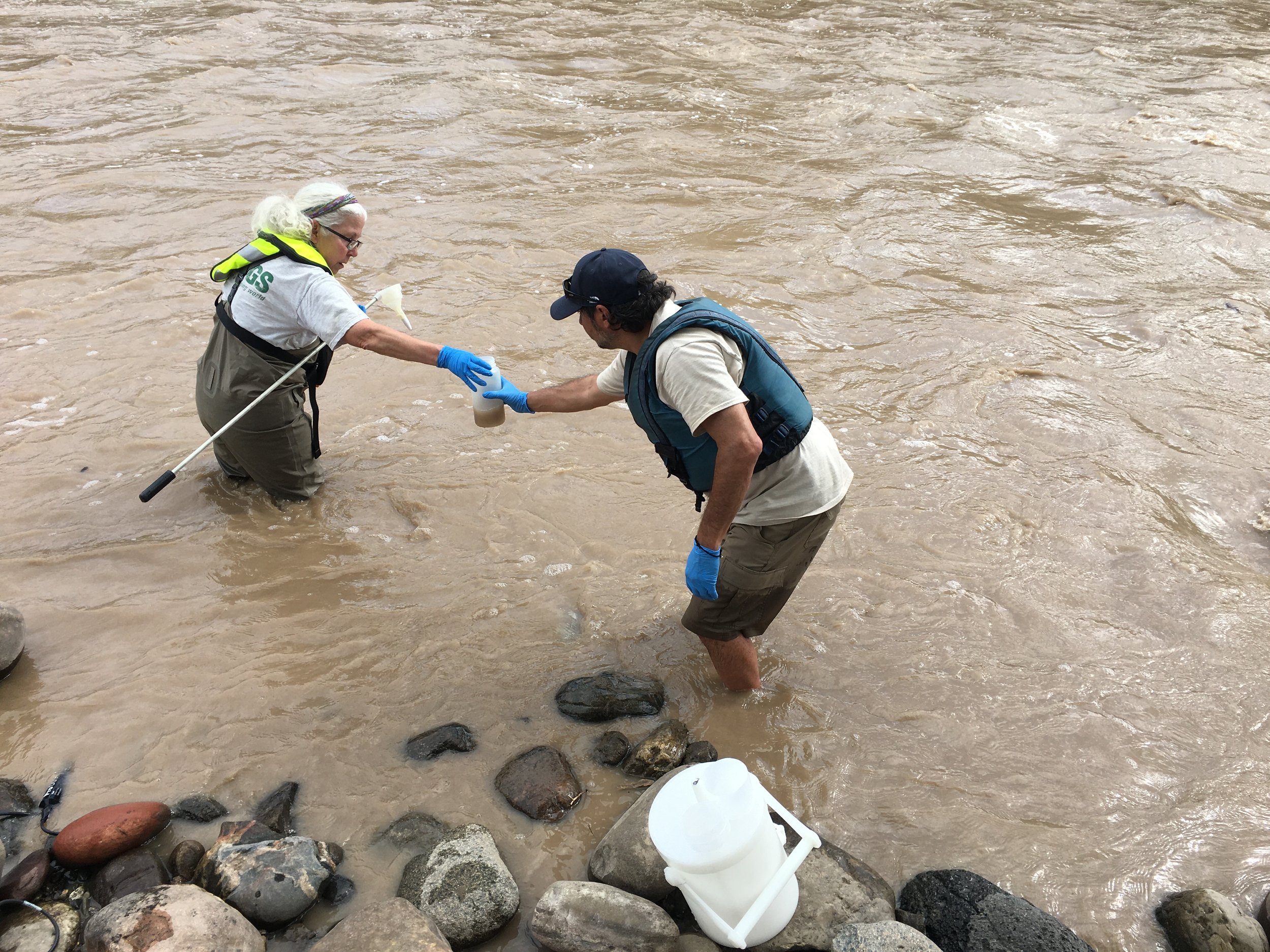
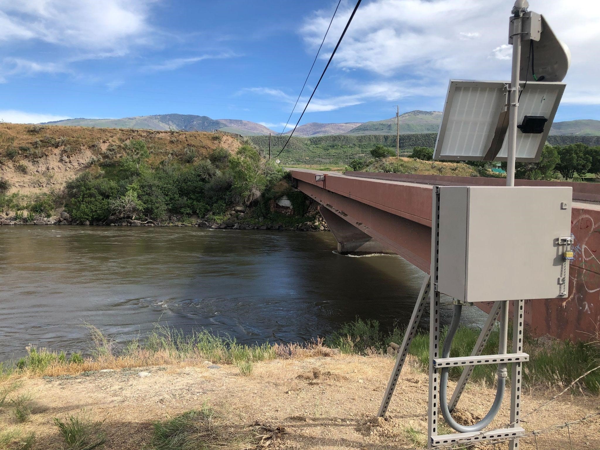
In April 2022, the US Geological Survey (USGS) installed advanced water monitoring technology with the, ISCO autosampler, on the Colorado River above the Roaring Fork River near Glenwood Springs. Controlled by a Python script linked to a water-quality sonde, the sampler triggers automatically based on turbidity levels and can also be activated remotely. The script interprets the turbidity values from the water-quality sonde in real time, and activates the sampler based on predefined thresholds. It can also be activated remotely via cellular telemetry.
The refrigerated sampler collects samples during rapid runoff events originating in the Grizzly Creek Fire burn scar, often occurring at night when traditional manual sampling is difficult. The nutrient analytes require preservation which is achieved in the short-term via the refrigeration function of the Avalanche sampler.
In addition to the ISCO sampler located at the Colorado River above the Roaring Fork River confluence, a custom mobile crane was fabricated to mount to a USGS UTV or pickup truck, allowing USGS to collect equal-width-increment samples from the nearby pedestrian bridge.

Equal Width Increment Samples from the Colorado River Pedestrian Bridge above Roaring Fork River
Water Quality Sampling Sites in 2022
In 2022, the USGS continued the collection of discrete water quality samples at the following locations within or near the Grizzly Creek burn scar:
Grizzly Creek above Colorado River
No Name Creek above Colorado River
Colorado River above Roaring Fork River
Mitchell Creek at County Road 136
The sampling locations on Grizzly Creek, No Name Creek, and the Colorado River all receive runoff from the Grizzly Creek Fire burn scar, while the Mitchell Creek location provides data for “baseline” conditions, as it was not impacted by the Grizzly Creek Fire. Four discreate samples were collected at each location.
The timing of each sample in 2022 captured a broad range of hydrologic conditions which can be observed in the Colorado River above the Roaring Fork River hydrograph below. Each yellow triangle represents a sampling event.
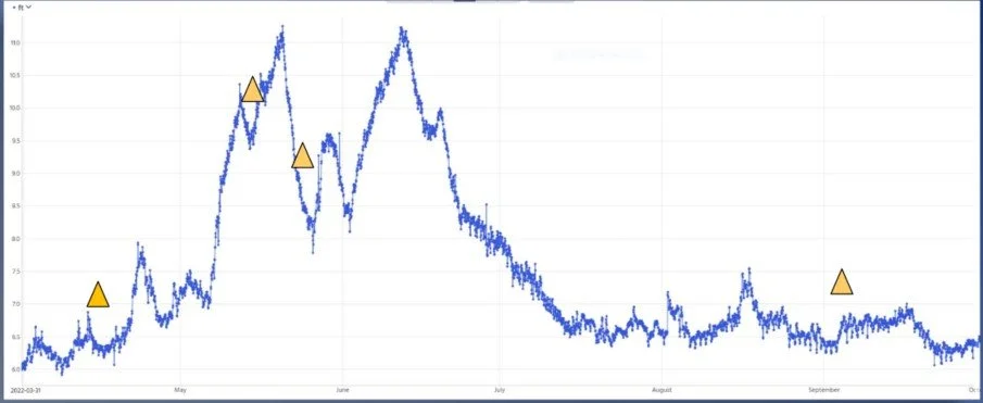
Colorado River above Roaring Fork Hydrograph April-Oct 2022 (triangles represent sampling events)
Analytes Tested
The discrete samples at these four locations are being analyzed for the following analytes:
Major Ions
Nutrients
Trace Elements
Dissolved Organic Carbon
Alkalinity
Ultraviolet Absorbance
Nitrogen and Oxygen Isotopes
Mid-reach Water Quality Monitoring Station
To reduce impacts to downstream water users and to promote operation of facilities receiving water impacted by post-fire contaminants and turbidity, additional monitoring equipment was installed to operate seasonally in the Colorado River in 2022. Due to a 61-mile gap between the USGS monitoring stations at Cameo and South Canyon on the Colorado river, adding mid-stream station locations allowed for more accurate water quality monitoring for downstream locations. Equipment purchased and installed by USGS included an ISCO auto-sampler and a YSI 5 parameter water quality sonde at Rulison, and a 2 parameter water quality sonde provided by USGS was installed at a site above Silt.

Meteorological Stations
Seven rain gauges were installed within the Grizzly Creek Fire burn scar in 2021 at the following complex monitoring stations, with corresponding legacy data:
These stations allow for five minute readings and data upload via telemetry every 15 minutes. Instantaneous alerts were sent to the National Weather Service (NWS), which was crucial during two separate radar outages during the 2022 monsoon season. The stations are currently monitored seasonally, due to paused data collection. The data linked
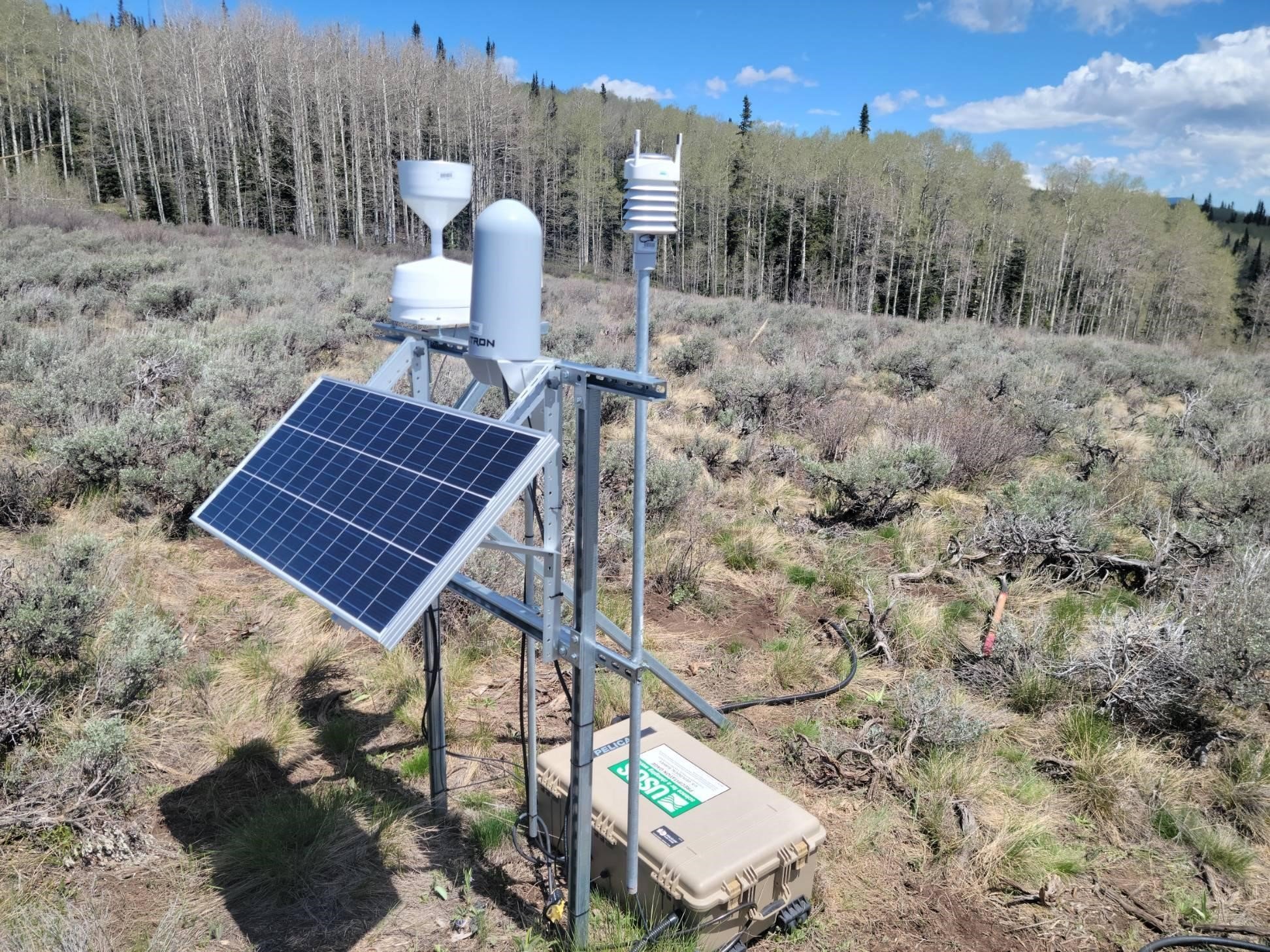
Soil Moisture Sensors
Seven soil moisture sensors were installed at four rain gauge sites in the Grizzly Creek Fire burn scar area, measuring moisture approximately 10 cm below ground in undisturbed soil to determine levels of absorption for melting snowpack and precipitation.
With drier soils, the snowpack will first be absorbed before contributing to runoff, which results in lower water levels in rivers, streams, and reservoirs. Soil moisture values will help refine rainfall thresholds for future events.
These sensors help assess soil absorption capacity, refining rainfall thresholds for runoff and debris flow risk predictions.Intended to monitor soil moisture conditions and report them on the USGS NWIS website in near-real time.
Sites that have redundant sensors and sensors:
Coffee Pot Soil Moisture Monitoring
Flows can be due to storm intensity and saturation excess. Many of the storms in 2022 experienced excess driven infiltration, but there were no debris flows with the rain events.
The instruments are co-located at precipitation gauge locations and are intended to represent local site conditions, i.e. the open meadows at the precipitation sites and not areas under a closed canopy nearby.
If the soil is dry, it first will be saturated by rain before additional rain percolates into the soil. Some sites have a better soil moisture response due to soil type, where the sensor is located, and various other external reasons. At the beginning of relaying data, there was some concern on whether the monitors were transmitting data correctly, but USGS was able to justify the responses through correlation with the associated rain gauges and other soil moisture sensors.